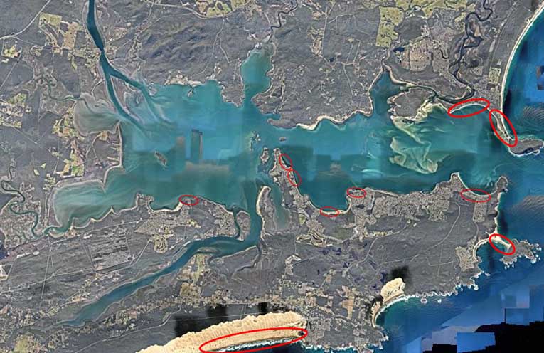
THE recent east coast low has resulted in changes and movement in the sand throughout the Myall and Port Stephens region.
 Advertise with News of The Area today.
It’s worth it for your business.
Message us.
Phone us – (02) 4981 8882.
Email us – media@newsofthearea.com.au
Across the Port, the Fingal Spit which was once vegetated, for the moment does not join Fingal Island to the mainland making crossing the spit extremely dangerous.
Lives have been lost on the spit crossing and current conditions make a crossing ill advised.
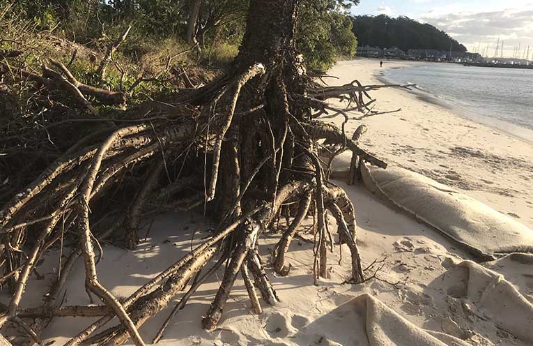
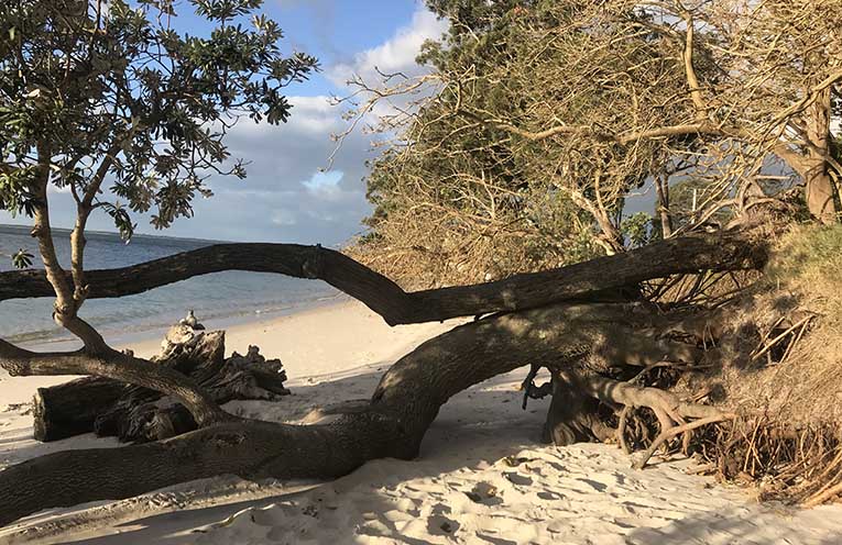
Further inland a large banksia at Corlette’s Conroy Park has been lost as a result of erosion of the bank and one of the Norfolk Island Pines has a large section of its root system exposed.
Landcare volunteer Margaret Wilkinson is devastated that we have lost another tree.
She and others locally have been lobbying for more sandbagging and a more permanent solution to erosion at Conroy Park.
Severe weather events are reshaping our coastline.
John Simpson holds a science degree and has worked in coastal management for 35 years, he is a local property owner who has a wealth of experience in sea level and climate change issues.
Mr Simpson told News Of The Area, “The sea level is rising; exactly what that rise is in Port Stephens I am not exactly sure in Newcastle it is 50-60mm; there is a standing rule about coastal recession that in a static environment like the Bay, with residual sand masses, that a rise in water level will result in a corresponding land recession of 150 times the height of the rise.
“A one centimetre rise in sea level will effectively see a 1.5m advance in shore recession, so a 30cm rise would see a three metre shore loss.”
“We are seeing the incremental change in water level to create a new stable shoreline – this typically happens during storm surges such as the East Coast Low and the tails of cyclones,” he said.
Mr Simpson believes that the best information available on rising sea levels predicts a rise of .6 a metre by the year 2100.
Gordon Grainger from the Myall River Action Group last week noted some recent television coverage where to do with the pending dredging of the eastern channel, providing fresh sand for Jimmys Beach sand renourishment and the flow of fresh oceanic water into the river and lake system.
For the Myall region, the dredge is now in the water and work has begun.
“It is anticipated to stay until end September and will provide quick and safe access to the Port for recreational craft as well as maintaining our river in its pristine condition,” Gordon Grainger told News Of The Area.
In our immediate region,areas at risk from erosion include Stockton at the north and south of the Bight, Jimmy’s Beach, Corlette, Shoal Bay, Salamander Bay and Soldiers Point.
Stockton Beach is the largest moving sand mass in the Southern Hemisphere with dunes reaching heights of over 30 metres with slopes of up to 60 degrees.
By Marian SAMPSON