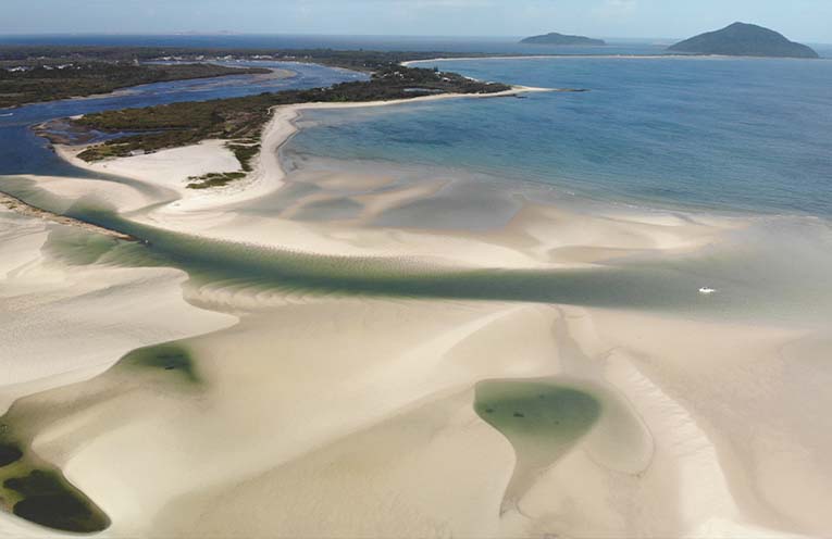
DREDGING of the Myall River estuary is yet to take place, despite recent pledges from Government representatives, and ferry services now regularly hitting the sandy bottom.
Frustrated by the apparent bureaucratic lethargy, Myall River Action Group’s (MRAG) Gordon Grainger has urged MidCoast Council, State MP Kate Washington and the Maritime Infrastructure Delivery Office (MIDO) to carry through their recent promises.
 Advertise with News of The Area today.
It’s worth it for your business.
Message us.
Phone us – (02) 4981 8882.
Email us – media@newsofthearea.com.au
“Council is committed to dredging the Eastern/Natural Channel in 2025, and the massive sand build-up at the mouth shows just how badly and quickly this needs to be done in order to keep the river in a pristine condition,” Mr Grainger said.
“The State Government agreed to fund the dredging of the Navigation Channel, to be achieved by mid-2024, but Council says that the necessary approvals process may take up to twelve months.”
A spokesperson for Member for Port Stephens Kate Washington said, “Recently, the NSW Government committed to fund the dredging of the Myall River navigation channel, working in partnership with MidCoast Council to obtain the necessary approvals and licences, we are working with MidCoast Council to ensure the dredging can be undertaken as soon as possible.”
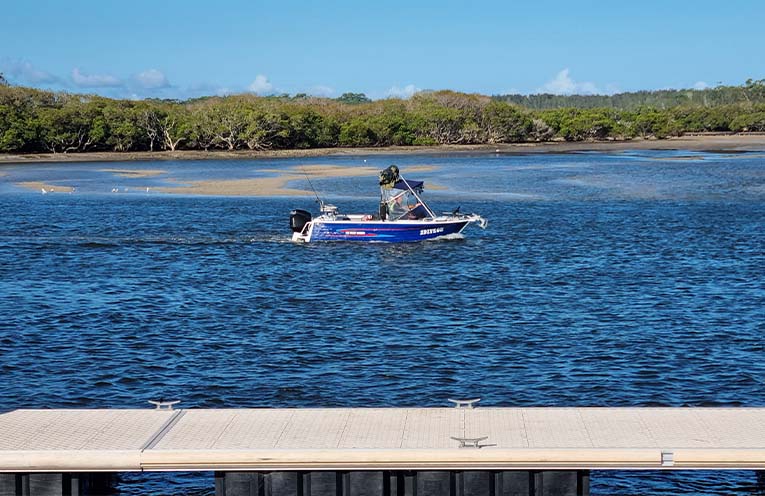
Meanwhile, both major ferry operators have reported the same rapidly deteriorating situation in the waters.
“We are striking the bottom in at least six spots between the entrance to the Corrie Channel and Tea Gardens,” Y-Knot catamaran ferry’s Noel Gaunt told NOTA.
“It is just getting shallower, we’ll have concerns over the particularly low tides at Easter’s full moon, the strongest tide of the year, with the highest highs and lowest lows.”
Kerrie Jeffreys from The Original Tea Gardens Ferry has similar concerns.
“We need to choose which vessel to use, now they are grinding a path through the sand, rather than just touching, in some places,” explained Ms Jeffreys.
“For the last week or two, we’ve been using ‘Jesse’, which normally does the upriver runs, as she has the smallest capacity.”
The most hazardous bottoming-out areas are at the dogleg before the artificial (official navigation) Corrie Channel, and adjacent Winda Woppa’s riverside, where vessels must zigzag to make the passage.
“Last Christmas, we touched sand outside Mumms on the Myall, which is the other side of the bridge from where the dredge pledge was targeted,” Ms Jeffreys added.
Whatever action eventually ends up being taken, there are still at least fourteen government bureaucracies, from local to Federal, that need to sign off on anything outside of the currently scheduled 2025 dredging of the Natural Channel to replenish the Winda Woppa stockpile.
By Thomas O’KEEFE